Start Location
Carpark at the North end of The Strand - East end of North Road
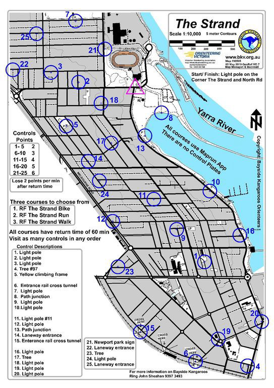
Carpark at the North end of The Strand - East end of North Road
Mainly street running - with lots of laneways that can confuse you if you're not paying attention. Take care crossing roads.
Three One Hour Score Courses; control descriptions are on the map. Please take care passing driveways and crossing roads.
Suitable for daytime or evening runs.
MapRun Information - see our MapRun Page for instructions
=> Start/ Finish Location; light pole on the corner of The Strand and North Road, Williamstown
=> Courses; "RF The Strand Walk, " RF The Strand Run" and " RF The Strand Bike".
Thanks to Bayside Kangaroos for providing access to their excellent library of MapRun-enabled events.
Bayside Kangaroos has taken a leading role in introducing new technologies to Orienteering. Click on the map to see their library of Western Suburbs and Surf Coast maps. If you're unsure of how to use MapRun - see our MapRun Page.
Can't be bothered taking a phone? No problem, just print the map and go for a walk or run. Enjoy yourself, but please stay local and avoid contact with others.
Mobirise web page builder - Check this