

You can download your GPS track directly from some GPS watches or go via Connect.Garmin or Strava.
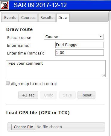
In RG, select the DRAW tab
Click on COURSE to select the course you ran in
Enter your name and a dummy time as shown (no idea why)
Click on Choose File and select your GPS file

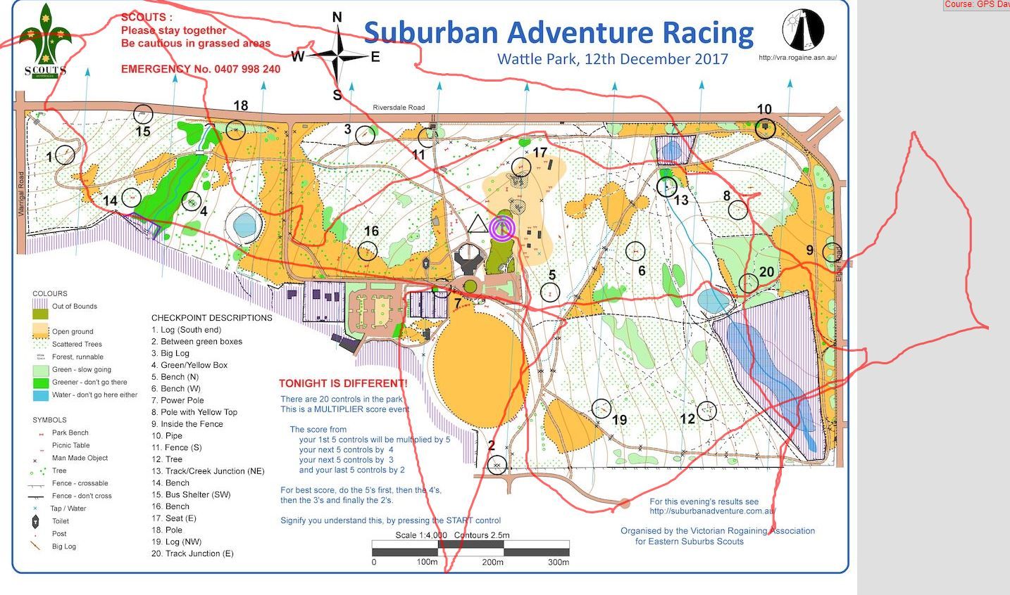
Many of our maps are rotated to allow them to fit on the paper - and RG doesn't know the scale....so it tosses the GPS track on top of the map as best it can.
Now you have to show it how to stretch/compress and rotate the track to fit it to the course that you ran. This seems daunting - but once you've done it once or twice, it's pretty straightforward.
The point on the top right is probably control #10 - click on the track at that point and a GREEN circle appears on the track. Hold the mouse key down and drag the green dot over to control #10.

Now, click on the green dot again and it changes colour to RED. A green dot can be dragged around as you did a moment ago. A RED dot is locked in position and will not move.
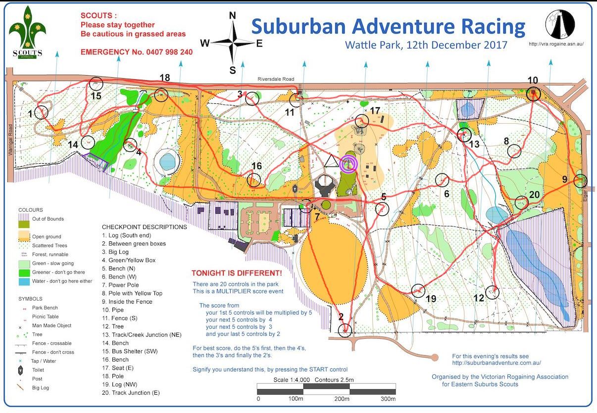
Now select another point - the bottom of the V in the bottom left looks like it was control #2 - so click on it, see the green dot appear and drag the green dot over to control #2.

You can see already that the track is looking pretty good.
If you want to fine tune your track, click on the RED dot and turn it back to GREEN. You can now drag it a little to get a better fit.
The best fit is when you use two points that are diagonally opposite. In theis case 10 and 2 are good choices - 1 and 15 are not good choices as it's difficult to see exactly where on the track the control was located.

Finally, just press the SAVE GPS ROUTE button and your track will be saved - for better or worse - for all to see.
